Schulenburgsche Karte von Brandenburg und Pommern, 1:100 000, 1767-1787
")
")


")

Titel: Schulenburgsche Karte von Brandenburg und Pommern
Person: Friedrich-Wilhelm Graf von der Schulenburg
Maßstab: 1:100 000
Datierung: 1767-1787
Anzahl der Blätter: 46 Blatt, 1 Indexblatt
Format: meist ca. 56 x 55 cm oder kleiner
Technik: Handzeichnung, koloriert
Signatur: Kart. N 1006
 https://kartenhighlights.staatsbibliothek-berlin.de/wp-content/uploads/SBB_IIIC_Kart_L-5420_Blatt-53_Ausschnitt-40000-dpi-scaled.jpg
2560
1992
AL
https://kartenhighlights.staatsbibliothek-berlin.de/wp-content/uploads/2020/11/logoSBB-SPK.svg
AL2022-01-07 01:00:552023-02-03 15:46:25Schmettausches Kartenwerk, 1:50 000, 1767-1787
https://kartenhighlights.staatsbibliothek-berlin.de/wp-content/uploads/SBB_IIIC_Kart_L-5420_Blatt-53_Ausschnitt-40000-dpi-scaled.jpg
2560
1992
AL
https://kartenhighlights.staatsbibliothek-berlin.de/wp-content/uploads/2020/11/logoSBB-SPK.svg
AL2022-01-07 01:00:552023-02-03 15:46:25Schmettausches Kartenwerk, 1:50 000, 1767-1787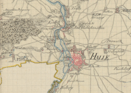 https://kartenhighlights.staatsbibliothek-berlin.de/wp-content/uploads/SBB_IIIC_Kart_N-1006_Blatt-12_Ausschnitt-40000-dpi.jpg
1521
1535
AL
https://kartenhighlights.staatsbibliothek-berlin.de/wp-content/uploads/2020/11/logoSBB-SPK.svg
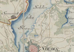
AL2022-01-06 01:00:122023-02-03 15:44:30Schulenburgsche Karte von Brandenburg und Pommern, 1:100 000, 1767-1787
https://kartenhighlights.staatsbibliothek-berlin.de/wp-content/uploads/SBB_IIIC_Kart_N-1006_Blatt-12_Ausschnitt-40000-dpi.jpg
1521
1535
AL
https://kartenhighlights.staatsbibliothek-berlin.de/wp-content/uploads/2020/11/logoSBB-SPK.svg
AL2022-01-06 01:00:122023-02-03 15:44:30Schulenburgsche Karte von Brandenburg und Pommern, 1:100 000, 1767-1787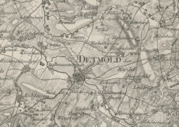 https://kartenhighlights.staatsbibliothek-berlin.de/wp-content/uploads/SBB_IIIC_Kart_L-12381_Blatt-14_Ausschnitt-40000-dpi.jpg
1241
1696
AL
https://kartenhighlights.staatsbibliothek-berlin.de/wp-content/uploads/2020/11/logoSBB-SPK.svg
AL2022-01-05 01:00:442023-02-03 15:48:15Von Le Coq, Topographische Karte von Nordwestdeutschland, 1:86 400, 1805-1813
https://kartenhighlights.staatsbibliothek-berlin.de/wp-content/uploads/SBB_IIIC_Kart_L-12381_Blatt-14_Ausschnitt-40000-dpi.jpg
1241
1696
AL
https://kartenhighlights.staatsbibliothek-berlin.de/wp-content/uploads/2020/11/logoSBB-SPK.svg
AL2022-01-05 01:00:442023-02-03 15:48:15Von Le Coq, Topographische Karte von Nordwestdeutschland, 1:86 400, 1805-1813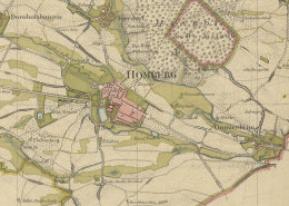 https://kartenhighlights.staatsbibliothek-berlin.de/wp-content/uploads/SBB_IIIC_Kart_L-7035_Blatt-95_Ausschnitt-40000-dpi-1-scaled.jpg
2370
2560
AL
https://kartenhighlights.staatsbibliothek-berlin.de/wp-content/uploads/2020/11/logoSBB-SPK.svg
AL2022-01-04 01:00:492023-02-03 15:49:12Von Müffling, Kartenwerk rechtsrheinischer und Hessen-Nassauischer Gebiete, 1:20 000, 1816-1828
https://kartenhighlights.staatsbibliothek-berlin.de/wp-content/uploads/SBB_IIIC_Kart_L-7035_Blatt-95_Ausschnitt-40000-dpi-1-scaled.jpg
2370
2560
AL
https://kartenhighlights.staatsbibliothek-berlin.de/wp-content/uploads/2020/11/logoSBB-SPK.svg
AL2022-01-04 01:00:492023-02-03 15:49:12Von Müffling, Kartenwerk rechtsrheinischer und Hessen-Nassauischer Gebiete, 1:20 000, 1816-1828 https://kartenhighlights.staatsbibliothek-berlin.de/wp-content/uploads/SBB_IIIC_Kart_N-501_Blatt-8_Ausschnitt-40000-dpi.jpg
1129
1581
AL
https://kartenhighlights.staatsbibliothek-berlin.de/wp-content/uploads/2020/11/logoSBB-SPK.svg
AL2022-01-03 01:00:542023-02-03 15:50:24Generalkarte von dem Preußischen Staate, 1:600 000, 1820
https://kartenhighlights.staatsbibliothek-berlin.de/wp-content/uploads/SBB_IIIC_Kart_N-501_Blatt-8_Ausschnitt-40000-dpi.jpg
1129
1581
AL
https://kartenhighlights.staatsbibliothek-berlin.de/wp-content/uploads/2020/11/logoSBB-SPK.svg
AL2022-01-03 01:00:542023-02-03 15:50:24Generalkarte von dem Preußischen Staate, 1:600 000, 1820 https://kartenhighlights.staatsbibliothek-berlin.de/wp-content/uploads/SBB_IIIC_Kart_N-729_Blatt-1765-von-1839_Ausschnitt-40000-dpi-scaled.jpg
1801
2560
AL
https://kartenhighlights.staatsbibliothek-berlin.de/wp-content/uploads/2020/11/logoSBB-SPK.svg
AL2022-01-02 01:00:232023-02-03 15:51:31Preußische Urmesstischblätter, 1:25 000, ca. 1820-1876
https://kartenhighlights.staatsbibliothek-berlin.de/wp-content/uploads/SBB_IIIC_Kart_N-729_Blatt-1765-von-1839_Ausschnitt-40000-dpi-scaled.jpg
1801
2560
AL
https://kartenhighlights.staatsbibliothek-berlin.de/wp-content/uploads/2020/11/logoSBB-SPK.svg
AL2022-01-02 01:00:232023-02-03 15:51:31Preußische Urmesstischblätter, 1:25 000, ca. 1820-1876 https://kartenhighlights.staatsbibliothek-berlin.de/wp-content/uploads/SBB_IIIC_Kart_N-370_Blatt-218-von-1847_Ausschnitt.jpg
1073
1188
AL
https://kartenhighlights.staatsbibliothek-berlin.de/wp-content/uploads/2020/11/logoSBB-SPK.svg
AL2022-01-01 01:00:452023-02-03 15:52:37Topographische Karte vom Preußischen Staat, 1:100 000, ab 1831
https://kartenhighlights.staatsbibliothek-berlin.de/wp-content/uploads/SBB_IIIC_Kart_N-370_Blatt-218-von-1847_Ausschnitt.jpg
1073
1188
AL
https://kartenhighlights.staatsbibliothek-berlin.de/wp-content/uploads/2020/11/logoSBB-SPK.svg
AL2022-01-01 01:00:452023-02-03 15:52:37Topographische Karte vom Preußischen Staat, 1:100 000, ab 1831
